Categories: all aviation Building a Biplane bicycle gadgets misc motorcycle theater
Sat, 19 Aug 2017
Seattle to Los Angeles in a Champ: Day 2
In the previous episode, I described getting myself from the Seattle area to Ashland, OR.
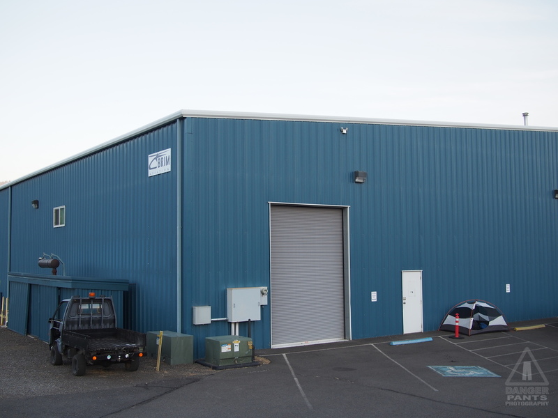
Hint: my tent is in the corner
I didn't sleep well in Ashland, overwhelmed by the sound of crickets and cars occasionally driving by on the road behind the airport. I was too warm to start, and then too cold until I woke up and dragged the sleeping bag over me. The sky started lightening around 5:30, and I was thoroughly awake by 6.
I'd planted the tent in front of a parking spot for the Brim Aviation hangar. As I was making my somewhat bleary way to upright, someone parked further down the lot, and came over, asking if he could help me (I had the impression he thought I was homeless). I explained that I was flying through and had sought a dark place to sleep, and he laughed. He said it was a good thing I was up, because they were about to get really busy with fire-fighting flights.
I finished packing myself up, and got the weather briefing on the phone (I was pleased to find that the terrible cell coverage I'd expected was actually pretty good, particularly once I was on the ground). Nothing of note except the smoke, which was going strong from a number of local fires. Norbert looked surprisingly majestic in the early-morning light as I packed up and got myself ready to go.
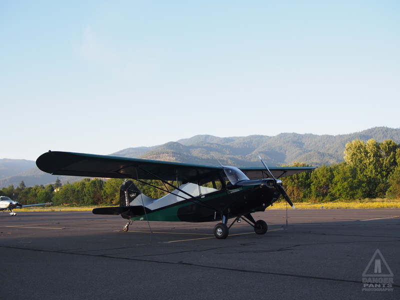
Norbert in the sunrise light
I got myself oriented, and taxied out to runway 12, surprising a deer as I went. It bounded over a wire fence, then turned to look at me curiously as I trundled past in my green and black plane. I lined up on the runway, and launched at 8:18 am. Someone had called on the advisory frequency that there were a pair of heavy military helicopters transiting the area, and they passed me by as I climbed away from Ashland, making altitude to get over the pass just south of town.
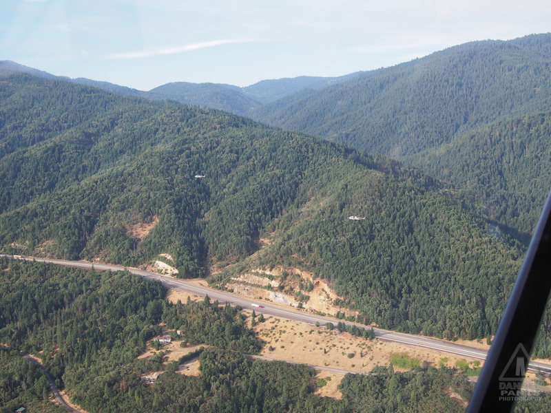
Two heavy military helicopters passed me by
Up and over the pass -- for some reason, it was really fascinating to see the roadworks under me as I flew over I-5 -- and into the valley beyond, for my first tantalizing view of Mt. Shasta. The smoke was pretty heavy, and I ended up climbing all the way up to 9500 feet (the highest altitude I aimed for on this trip, though I reached it several times) to get clear of the smoke. The smoke continued to have its interesting scent, but I blew my nose orange afterwards, so I think I'm happier to have not lingered there.
The route that I-5 follows after Ashland is well defined by a series of distinct small mountains to the east. I had a vague impression that they might have been formed by a giant putting down a series of toy mountains and arranging them for a pleasing visual effect. Of course, I viewed all this through a layer of smoke, and the haziness contributed to the dreamlike feeling of it.
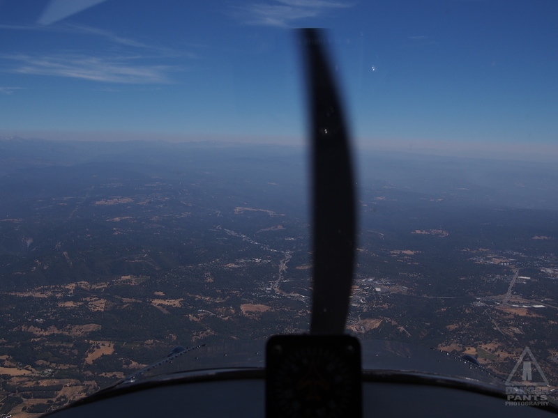
Onward and upward. I finally reached 9500 feet, and leveled out to cruise above the smooth white layer of smoke. I noticed an odd optical illusion, where when I looked at something that I thought was level with me, evidence told me it was actually lower. For instance, I would have sworn the smoke layer was level with me as I passed Mt. Shasta, but I knew for a fact that it was between five hundred and a thousand feet below me. The illusion was particularly strong when looking at mountain peaks. I'd spot one that I was sure I'd smack into if I flew over it, and on the chart it said the actual elevation was two thousand feet below me.
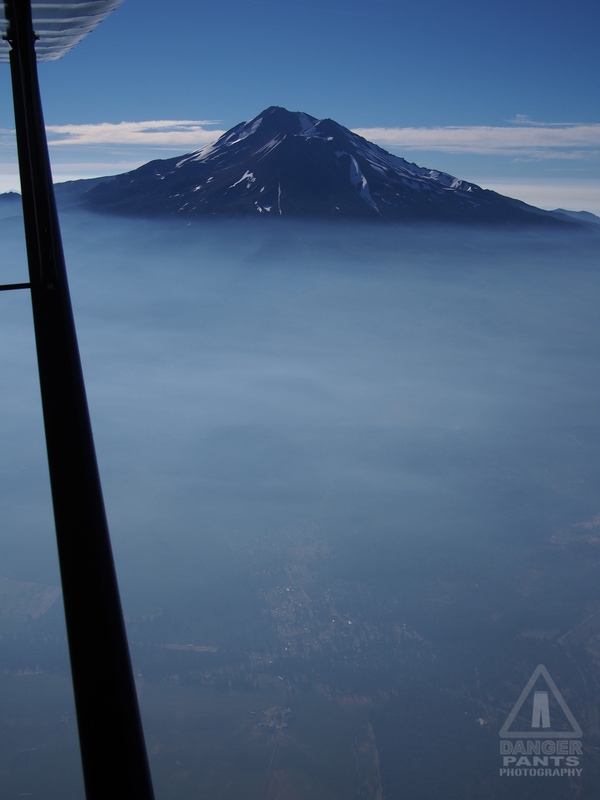
Mt. Shasta from 9500 feet, civilization just visible below
Once past Mt. Shasta (which has its own weather station, that I tuned into as I passed), it was over the many-tentacled Shasta Lake, and on to the broad, flat valley that starts at Redding, and continues south all the way to the Grapevine mountains that spread north of LA.
My next stop was at Willows (WLW), which I had initially (ha!) planned to be my first day's stop. It took me nearly 3 hours to fly from Ashland to Willows, and although I could have done it had I launched exactly on schedule, I'm really glad I didn't. The remainder of the flight to Willows was unremarkable except for one thing: the temperature inversion.
As I descended into Willows, the temperature on my $6 aquarium thermometer (with the temperature probe jammed into the little fresh-air vent around ankle level), the temperature slowly climbed from about 20° C at altitude to the high 20s, then there was a palpable spike. I wasn't looking at the meter as I descended, but I could feel it as I passed into the inversion. Suddenly it seemed like it was 10° C hotter.
Willows, CA (WLW)
On the ground in Willows, it was hot and dry. I pulled up to the self serve tank, and filled the plane up. I had been in communication with Glenn, who I was hoping to visit in Placerville (PVF), both to meet him, and to see his airplane. As you can read elsewhere, I'm just starting on a project to build a Marquart Charger biplane, and Glenn is a huge proponent of the type online. When he moved to California as I was planning this trip, it was obvious I'd have to stop in.
So, I launched from Willows just past 11:30 am, and climbed to 7500 feet, as much to escape the heat as anything else. I flew past Sutter Butte, which is an odd sight in the middle of the otherwise completely flat plains of the valley. I had to give Beale Air Force Base a wide berth, as they had a Temporary Flight Restriction around the field, which seems to be pretty much perpetual. Once I was around that, it was direct to Placerville.
Placerville is somewhere in them thar hills
The approach to Placerville was hillier than I'd been expecting. The map shows that it's in the foothills of the mountains, but somehow it doesn't make clear just how hilly it really is. As I dropped down once I was finally sure I had the field in sight (I didn't want to lose altitude until I was sure where I was going to land: the Champ is not a quick climber), I traded radio calls with someone else who was departing, and fought the controls a bit as the wind tossed me around. I braced myself for a difficult landing. It was on the "handful" side of the "easy-peasy:handful" spectrum, but manageable.
As I was tying the plane down, I got a text on my phone: "We're sitting at Norbert's ten o'clock in the open hangar." I walked over and shook hands with Glenn and his wife Judi, and we immediately started into the biplane talk. We've been conversing online for many months as I've sorted out what kind of biplane I wanted to build, and we were immediately comfortable talking planes.
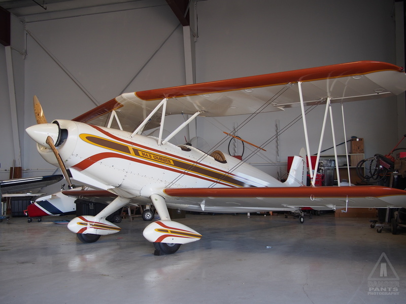
Glenn's Charger
Glenn showed me over his plane, and some of the special touches the builder put in. I sat in the cockpit and noted how I fit -- generally pretty well, though the rudder pedals were a bit closer than I really wanted them, but it's simple enough to get them placed properly while building. My plane will definitely have the pedals in the right spot, and I will hopefully build them in such a way that they can be moved for different pilots (though perhaps not easily).
Glenn kept glancing apprehensively at the windsock on the runway, and I could see why. It would swing back and forth between running directly down the runway (good) and straight across the runway (bad). The fact that it was variable was the worst part of the situation, though. It would make landings in the comparatively twitchy Charger somewhere between "handful" and "disastrous" on the ol' spectrum. "Easy-peasy" was not in the offing. So we decided to go to lunch instead. We had a lovely Mexican lunch at the base of the hill on which the Placerville airport is perched.
Back at the airport, the weather had calmed just enough that Glenn was willing to go flying, so he prepped the plane and pulled it out. I slipped on the flying helmet and goggles, he fired up the engine, and we taxied out to the runway.
The takeoff was interesting: the movements of the plane were much more sharp and definite than the Champ. The tail raised abruptly, and we lifted off very definitely, with none of the "yeah, sure, I guess" feeling the Champ conveys. Of course, it's got 60 additional HP (150 vs. the Champ's 90), and only weighs a hundred or two hundred pounds more.
We climbed for a minute or two, chatting over the intercom as we flew. My microphone was quiet, so I found myself covering the mic with my hand and leaning forward to avoid the wind noise that constantly threatened to drown me out.
Glenn gave me control of the plane, and I did some gentle maneuvers -- we were both feeling full of heavy Mexican food, so aerobatics were definitely not in the cards -- getting a feel for the plane. For the short time that I flew it, it was very pleasant and really just felt like an airplane. There was nothing surprising about it, it just did what I asked it to do. I wasn't willing to wrench it around between my lack of experience and our full bellies, but my time at the stick was pleasant.
I noticed that I also felt much more in control than my last open-cockpit flight, in Oregon with Dave in his Starduster. Not that anything was substantially different beween the Charger and the Starduster; I think the big difference was between my ears. I was much more mentally prepared this time, I think.
When we were back down, they offered me a place for the night in their spare room, which was a very tempting offer (particularly as I thought back on the night half-awake in a tent in Ashland). However, I felt a powerful urge to keep moving: LA was still over 300 miles away, and I needed to cover more distance.
So, I bade them a fond farewell, and went back to my plane. I filled it up with gas as the wind gusted around me, and taxied out to the runway. Glenn and Judi were right behind me, bound for an ice cream social at a nearby airpark. It was funny to watch their short flight on my ADS-B display, which shows a map overlaid with my route, and other airplanes in the air around me. I took off just before 5:30 pm and aimed myself southward for somewhere between Fresno and Bakersfield.
My destination wasn't exactly set in stone. I'd targeted Porterville (PTV), which has the cheapest fuel in the area, but the GPS remained insistent that I would arrive about 15 minutes after sundown. Since the plane isn't legal to fly at night, I considered my other options. Cell coverage came and went at random in the air, and I tried several times to look up the local airports online as I flew. I finally got my search result back, and decided on very little information to try for Mefford Field (TLR) in Tulare. The fuel price (five cents per gallon higher than PTV) was the only definite fact I had, but I assumed based on its size and location that there would be facilities like a bathroom available. The GPS said I'd be there just before sunset, so I decided that was good enough.
Flying a plane built in 1956 when you're my size is always a compromise. Planes were built for the size of the average person at the time, which was about a 5' 7" man who weighed 150 lbs. I am... larger than this. The problem I was really running into was that my legs are longer than the stretch to the pedal was designed to accomodate. Add to this that my body has started getting painfully stiff in the knees if I sit in one position for too long, and there was a recipe for some trouble.
I had discovered as I flew down to Ashland that I could cross my legs around the control stick, though this left the problem of cruise rudder: the plane needs a pretty constant 3 or so pounds of pressure on the right rudder pedal. It's not a lot, but if it's not there, the plane flies a bit crooked (or "uncoordinated" in pilots' parlance). An uncoordinated plane is basically flying with one side to the wind, which makes everything less efficient and increases drag by a lot.
The thing I realized as I sat there with crossed legs was that the rudder pedals for the passenger (who sits behind the pilot) are right next to the pilot's seat. I could drop my hands right onto the rudder pedal on either side of my seat. So, I just added that rudder pressure with my right hand while I flew with my left. It was hard to coordinate the controls, but I worked on it as I flew and slowly got better.
Crossed legs didn't solve the problem that I really wanted to straighten my legs, but at least it resolved the issue of keeping my knees in only one position for the entire flight.
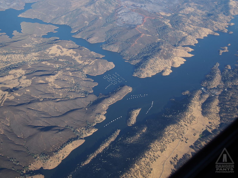
I think those are house boats
Flying over the hills toward Mefford, I passed a number of lakes that seemed to have a series of house boats on them. There was no obvious way to get to or from the house boats, so I'm not sure what the deal was with them. Perhaps there was some kind of water taxi available.
I had a small monocular (basically a compact telescope) with me, and it came in handy any number of times to identify things on the ground, or occasionally other planes. Telescopic examination of the little white dots on the lake suggested they were house boats, mostly because I couldn't imagine what else would be shaped that way.
Soon enough I was past the hills and back out over the flat valley plain. It was another race with the sun, but the sun had a dirty trick up its sleeve: as I went further south, sunset got earlier and earlier. Still, I was once again able to get my wheels on the ground a few minutes before the sun completely disappeared below the horizon.
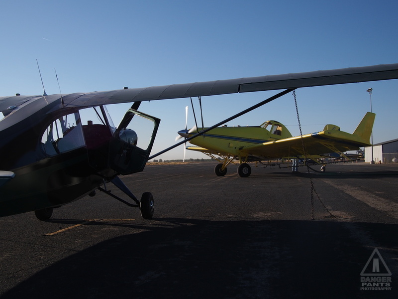
Norbert faced by a large crop duster the next morning
Mefford Field was not really what I was expecting, though it made perfect sense for where I was. There was a self-serve tank, and I'd noted a sign for Johnston Aviation pointing the opposite direction of where I was going. But other than that, there was a small crowd of very distinctive looking agricultural spraying planes: crop dusters, and not much else. There was no FBO (fixed base operator, the jargon for the typical pilot services business found on most airstrips), and it became increasingly obvious that I would have no access to a bathroom. I picked a tiedown spot that was further away from the lights, and noted with interest the dust skittering away in the wind as I pulled the chains out of their recesses in the pavement to hook the plane to the ground.
Tied down, I pitched my tent, suddenly aware of the noise of the freeway only a couple hundred feet away. The pavement radiated heat, adding to the heat that was already in the air -- I took a picture with the thermometer in the background, blurrily showing what I think is 37° C (98° F). I am not a great fan of heat, and I knew it was going to be an uncomfortable night. I thought harder about finding a hotel in nearby Tulare (pronounced "to-larry"), but laziness overcame me. I washed my face off at a hose attached to one of the hangars, and did my best to sleep on my thankfully insulated sleeping pad.
Next: Over the Grapevine and flying with David
Posted at 21:04 permanent link category: /aviation
Categories: all aviation Building a Biplane bicycle gadgets misc motorcycle theater